Environment
Landscape and biodiversity
The EXOq landscape design is informed by the Oxfordshire Nature Recovery Strategy.
New hillsides will soften views into the site and provide views out to the countryside.
New wetlands, meadows, scrubs and woodland planting, in addition to green roofs on proposed buildings, will ensure that a 10% net gain in biodiversity is achieved.
The Oxfordshire Nature Recovery Strategy
The Oxfordshire Nature Recovery Strategy sets out some high-level guidance for the area which include targets for the creation of the following habitats.
• Species rich grasslands including lowland meadow and grazing marsh.
Wetland habitats.
Woodland.
Diverse native hedgerows.
Mixes of habitats that include grassland with integrated trees and/or native scrub.
To support and nurture an innovation ecosystem, the proposed campus needs to be a high quality and attractive environment.
The most distinctive natural feature is the gently falling hillscape that meets the Oxford Canal which runs along the western boundary.
The site is currently arable, planted with a mix of grasses, legumes and areas of grassland, vegetation and scrub.
Areas of woodland border the site to the north, and Stratfield Brake to the north-west contains a mix of wetland and woodland habitats that are local wildlife sites and accessible to the public.
These landscape features, along with high level guidance from The Oxfordshire Nature Recovery Strategy, have been used to shape the proposals, which include creating a large area of natural open space to the west of the site, offering the potential to extend the character and public use of Stratfield Brake southwards and along the canal.
On the eastern side, in front of the proposed development, the levels of the site will be sculpted to form new hillsides, offering views over the countryside, including Spring Hill and Wytham Hill, and softening views from those locations back towards the site.
Wetland features
A series of wetland features would wind down the valley, joining a series of large ponds and wetlands within the low-lying land to the west of the site.
These water features and wetlands would extend the existing habitats at Stratfield Brake and deliver the aspirations of the Oxfordshire Nature Recovery Strategy.
Wildlife corridors
Boundary tree lines will be retained and enhanced, except for small sections required for access off Frieze Way. Buffers and dark wildlife corridors are proposed to protect the woodland to the north as well as the retained tree lines.
Trees and buildings with the potential to house bat roosts will be retained. These measures will ensure the protection of the Local Wildlife Sites at Stratfield Brake and the Oxford Canal and create new habitats to increase the wildlife potential.
The proposed wetlands, meadows, scrub and woodland planting in addition to green roofs on proposed buildings will ensure that a 10% net gain in biodiversity will be achieved.
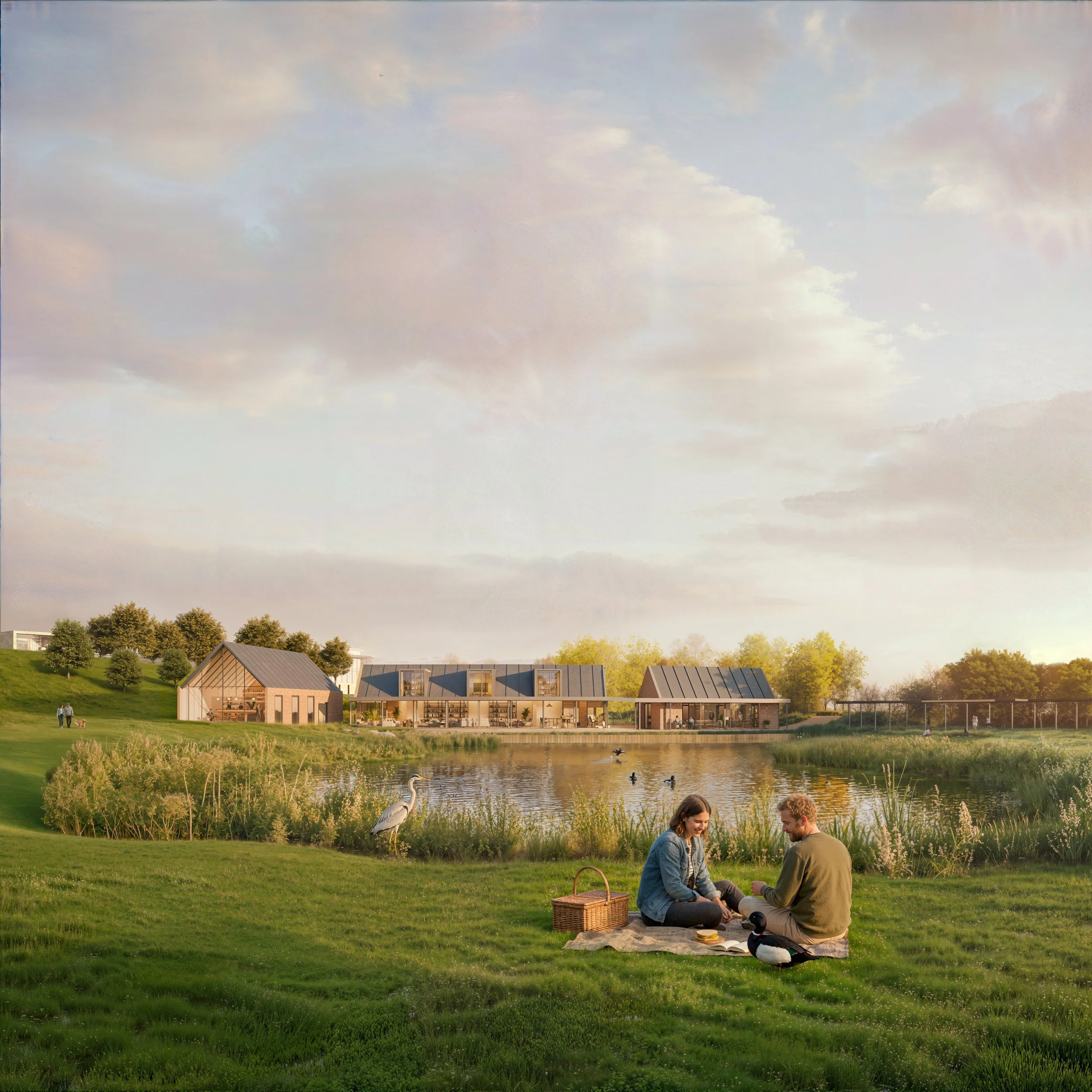
New wetland features like those at Stratfield Brake will be provided within the park and integrated with a community cafe, hall, and public WC facilities at the site's western edge near Oxford Canal.
Conservation and heritage
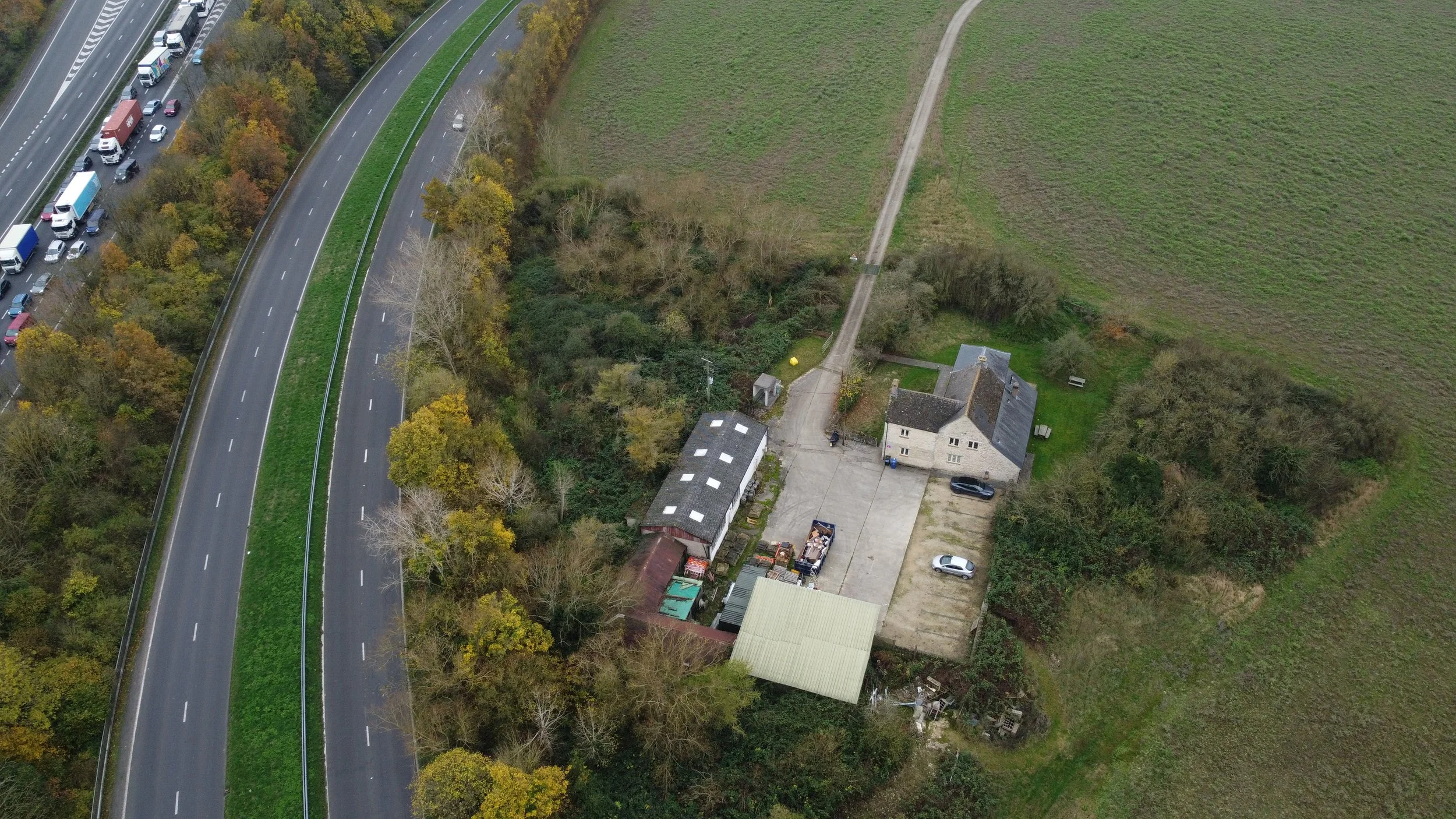
The project consultants have undertaken detailed studies of the site to assess the likelihood of any important archaeological features, and to consider how the new proposals might impact on known heritage assets on and off-site, including the Grade II Listed ‘Frieze farmhouse’ which sits in the south east corner of the site and the Oxford Canal conservation area which is located immediately to the west of the site.
The site has seen significant change during the second half of the twentieth century with the delivery of the road system and the amalgamation of the historic former field system. As such the site and the immediate surrounding landscape has limited ‘time depth’. This notwithstanding the canal is an important historic feature, and protecting and enhancing the setting of this has been a key driver for the masterplan.
In terms of archaeology, a geophysical survey has been conducted to understand the potential for archaeological remains within the site. This has identified the potential for some archaeology in the south-eastern part of the site, and it is thereby proposed that archaeological investigations will be undertaken prior to any development of the site.
In terms of on-site heritage assets, the site accommodates a Grade II listed farmhouse, which is described as a typical example of a modest Oxfordshire vernacular building of the late 17th century which was successively enlarged between the 18th and 19th centuries.
The building is now used as offices. The historic farmstead associated with the farmhouse is still evident and is described as a ‘loose courtyard’ arrangement, however this has been heavily altered and now detracts from the character of the farmhouse somewhat. The masterplan retains the farmhouse entirely unaltered, protecting the setting of the building with enhanced planting and facilitating the future renovation of the farmstead.
The proposals have been drawn up to respect the Grade II listed farmhouse on site.
Masterplanning has been guided by Oxford Canal conservation area reports.
The investigation process has been approved by Oxfordshire County Council’s Archaeology Service.
Most of the new development is focused away from the Oxford Canal conservation area, closer to later 20th-century infrastructure, and the Conservation Area Appraisal has guided much of the masterplanning:
The new built form of the development is focused in the north, east and southern zones of the site.
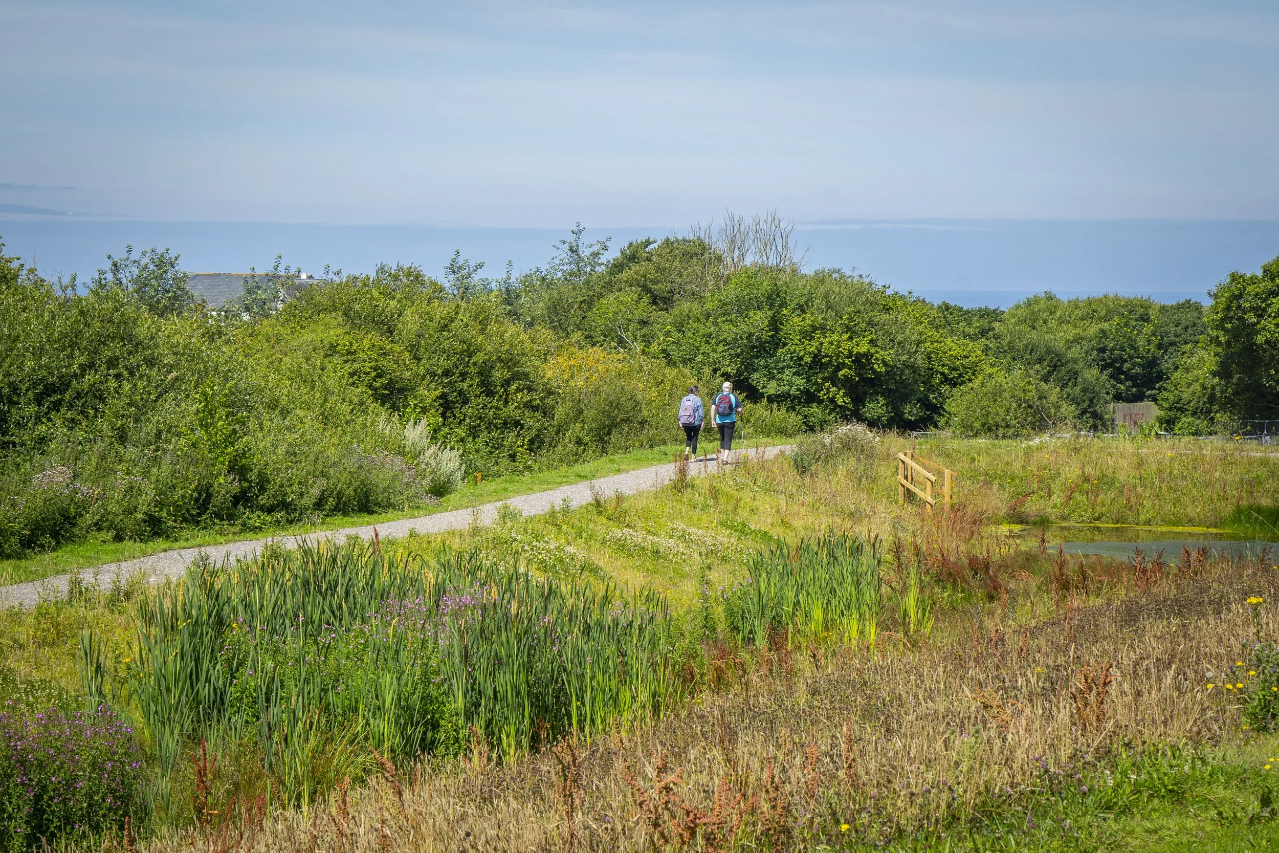
Land immediately to the north of the site, between Stratfield Brake and the canal is currently managed as a strip of ponds and wetland adjacent to the canal. The design proposals extend this pond and wetland zone alongside the canal.
A wide zone of green open space lies between the ponds and the curving zones of new built form, providing new public access to the wetland and towards the canal.
Foot and cycle paths through the open space will provide new access and use of the land around the canal.
Further investigations will be carried out to support a future planning application.
Drainage and surface water
The great majority of the site is in Flood Zone 1, which is land at the least risk of flooding.
To the very west of the site are small areas of Flood Zones 2 and 3, where it has been identified that there is a risk of flooding from the nearby canal. This is known as fluvial flooding.
There are also areas where there is a risk of pluvial flooding from surface water – that is to say caused by rainfall rather than from the canal overtopping. The largest such area is again in the west, but there is also a small area next to Frieze Way.
There will be no buildings in areas at risk from fluvial flooding and steps will be taken to deal effectively with any other potential issues across the whole site.
A surface water drainage strategy, which will accompany a future planning application, will demonstrate that the risk from surface water flooding will be mitigated, and the development will be safe throughout its lifetime.
The site is in an area which is less than 25% susceptible to groundwater flooding.
Most of the EXOq site is in Flood Zone 1 and at low risk of flooding.
Building will not take place in the areas at greater risk, near the Oxford Canal.
A sustainable drainage strategy will manage surface water run-off.
The existing watercourse which runs along the northern boundary of the site will be used as the discharge route for surface water run-off, which will be managed by a variety of sustainable drainage systems, known as SuDS.
What are SuDS?
Sustainable drainage systems (SuDS) are a set of water management practices designed to help slow down, store and filter rainwater in a more sustainable way than traditional drainage systems. These are likely to include:
Blue roofs: These are flat roofs which temporarily hold back water at times of heavy rainfall and storm events. They treat and release the water at a managed and controlled rate.
Detention basins and ponds: Detention basins are surface storage basins designed to manage stormwater runoff. They store water and release it slowly once the risk of flooding has passed.
Swales: These are shallow, wide channels designed to store and convey runoff. Because they are vegetated, they can help to remove pollutants.
Rain gardens and bioretention features: The ability of undeveloped land to retain rainwater naturally in the soil is known as bioretention. Rain gardens and similar bioretention features are designed to mimic this ability – rain can soak into the soil, and the plants are species chosen because they are able to thrive in such environments.
A SuDS ‘corridor’ through the centre of the western site is being developed with the Landscape Architect to improve biodiversity and water quality, and to provide an aboveground route for surface water run-off to reduce the dependence on below-groundpipework in this area.